Route Alignment for Power Transmission Line using Drone
Before a Power Transmission line is constructed, a design survey to map the transmission corridor is necessary. In this project under Route alignment of Power Transmission line project employ both GNSS and Drone techniques. Unmanned Aerial Vehicles (UAV) are capable of providing meter-level accuracy in engineering surveys.
Transmission lines form the backbone in power networks, being the installations, which transmit power over long distances. The success of the electric installations partly depends on the technical know-how of a geomatics engineers and the contributions of other disciplines. However, the movement of electric energy needs supporting structures, conductors, insulators, and appropriate connecting hardware whose spatial locations depend on the expertise of geomatics engineers. Thus, GIS plays a noteworthy role in route alignment optimization.
This study focuses on exploring the significance and impact of employing drones for surveying purposes in the terrain of Arunachal Pradesh. The integration of drones equipped with advanced imaging and data-capturing technologies will have immense impact and transform the landscape of surveying methodologies, enabling precise and comprehensive data collection across diverse terrains and environments.
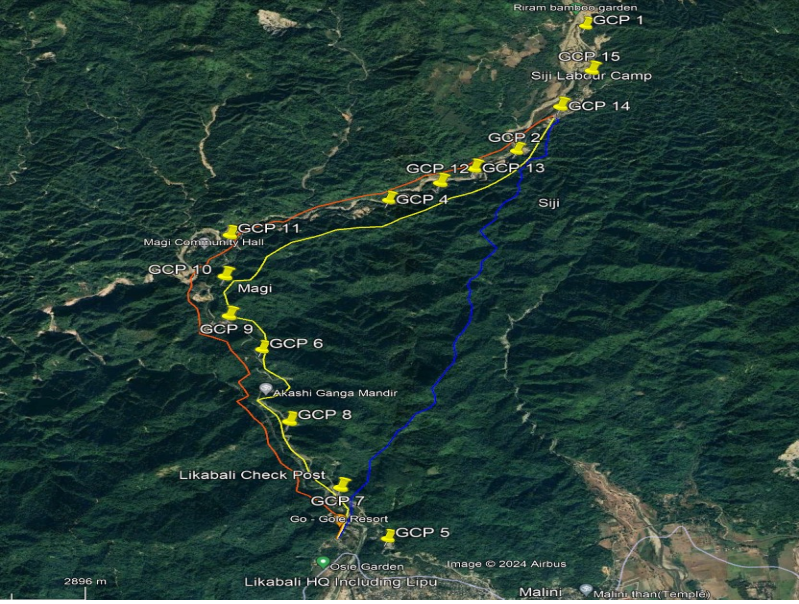
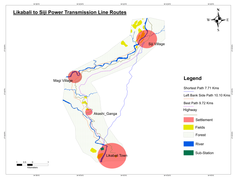
On an average in 1 km of route, around 3-4 nos. of Tower construction are carried in terrain area, especially in Arunachal Pradesh (inputs from Power Department) depending upon the line of sight. Using the network analyst tool on ArcGIS pro software over the Contour generated, the best path was selected by comparing the altitude difference between two contour lines, where the minimum difference was kept in between 10-20 meters. The generated best path is along the east side of the national highways crossing Magi village, measuring a length of 9.72 km with a mean elevation difference of 150 meters.
Using the same method between Likabali and Siji, shortest path and left bank path was also calculated, which is found to be 7.71 km with an elevation difference of 526 meters, and 10.1 km with an altitude difference of 357 meters respectively, but most of the area falls under dense forest and other side of the river.